Sunday 16 October 2011

Leeds and Liverpool Canal Path - After


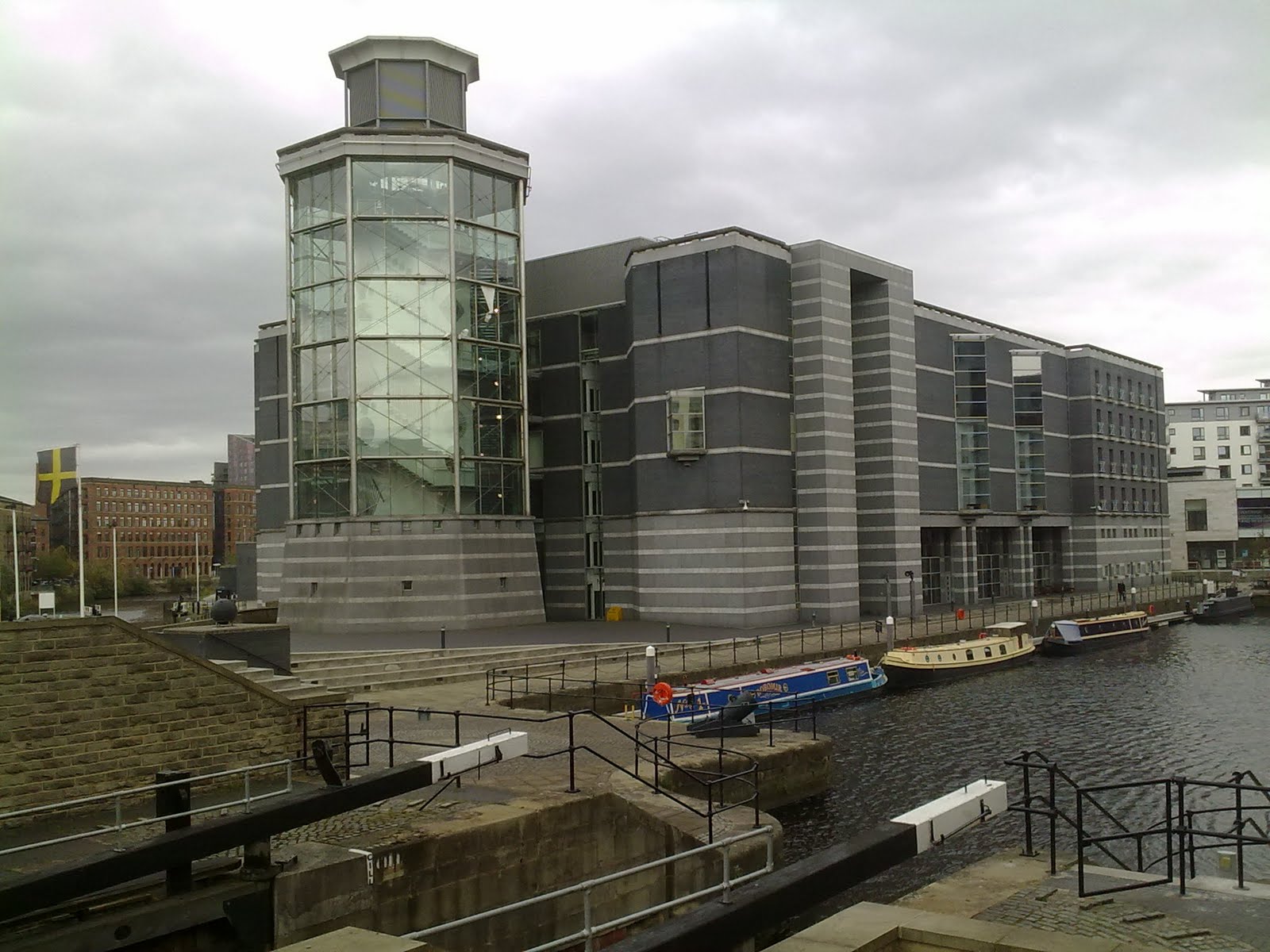
It seems crazy to me that so many Tourist Information Centres (TIC) have closed down – which they have if you hadn’t noticed. I rarely reserve accommodation, preferring the benefit of the freedom to choose, when and where to stay overnight, on arrival. Letting the TIC’s accommodation booking service do their best at the end of my walking day has balanced my luck and has been worthwhile for all concerned; I’m shown room availability matched against personal requirements, the TIC gets a fee (10% of the room tariff) and the inn, a last minute booking (less 10% of tariff). As a last minute booking there’s usually a discount too. TICs are a wealth of local information. So, for me, on The Leeds and Liverpool Canal Towpath walk, TICs were sorely missed. And will be in the future too. RIP TIC.

Finding accommodation was critical on this walk because I wasn’t carrying a tent, sleeping bag, food and cooker. It did feel odd but marvellously light; my pack was a very comfortable 15lbs or so. Prize winning item was the Golite Dome Umbrella. Lightweight (215g), unbelievably strong (bendy) and in strong wind/driving rain it feels indestructible. A backpacker with an umbrella might seem out of place (Hiram Holiday with a rucksack) but it does the business, like the TICs used to.

Would I walk a towpath again? Yes. With a bit more research beforehand – I over relied on chance, even shorter distances perhaps giving time to visit local attractions, and a bed booked in advance as well next time round.

Monday 10 October 2011

Leeds and Liverpool Canal Walk - Day 6

Blackburn - Chorley (12 miles)

My target today was Bridge 76A. Although just beyond the turn-off point from the canal into Chorley, 76A is special. Apart from it being the likely end of my canal walk, the bridge and I share a name, it being The Cowling Bridge. Something else we shared on the day too - we were both, errr - clean, through to the skin/metal, washed by the constant rain.

It's a twenty minute walk from the canal into Chorley town centre. A decent town centre - modern, with a covered market, an interesting mix of shops, pubs, restaurants, etc, and a Booths supermarket - a quality store in my opinion and a bonus point for Chorley. Things were on the up after the disappointments of Burnley and Blackburn.

It got better though. My B&B for the night, a 10 minute walk from the town centre, is totally excellent. All it says on http://www.inglewoodboutiquebandb.co.uk and more. Plus it is within 200 yards of a great restaurant http://www.new-season.co.uk which has a pub either side of it. Now THIS is what I'm talking about.

I have one scheduled walking day remaining but I'm finishing here - on a high. Wigan became my expected last (canal) port of call (although never my intention, two more days at my pace and I would have reached Liverpool). The relentless rain is taking the fun out of this stroll though.

Luckily for me, Chorley has a direct rail service to south Cumbria where I left my dog and van. I'll blog again on Sunday. I've whinged a bit here so an apology may be in order, plus, I'd like to mention one most excellent item of kit that I carried.

Image: The Cowling Bridge, Chorley.

Sunday 9 October 2011

Leeds and Liverpool Canal Path - Day 5

Burnley - Blackburn (17 miles)

It's not good when I think, "Crumbs, is it only day 4!". So you may already suspect that it hasn't been a cheery day for me. The truth is, that today's walk was a bit of a trudge - head down in the rain with few people out and about.

In wet weather I share the towpath with joggers isolated in their Ipod worlds and the odd (one or two odd, not odd odd) angler, who mostly resolutely stare at the canal, refusing to catch my eye as I glide past, considerately, not wishing to frighten off the fish. "Is it 'cos Ize a backpacker?" I wonder. Or is it their fear perhaps that if they look up to say "Ow do?", (or preferbly a greeting with the letter "u" in it - I like the Lancashire accent) the waiting fish will seize the moment, nick the bait and leg it (or should that be fin it?).

I just checked that; swung head sideways and upward, saying "Ow do?" with the head returning to face make-believe water before completing the word "do". Takes less than a second I reckon. It's just possible to carry out the same exercise but swivelling the eyes, straining at the sockets, to keep watching the water. Hurts a bit though. Looks weird too.

Listening to Blackburn Cathedral bells (as I circle the building, searching but failing to find a good spot to take a photo) lifts my spirits for a while but they sink again slightly when wandering around another familiar-looking town centre, all mall and no soul (searching and failing to find a good pub or restaurant).

What chance the next two days - Chorley then Wigan. I can deal with the rain so fingers crossed for a friendly pint, a hearty meal and quality accommodation.

Image: Entrance, Blackburn Cathedral.

Saturday 8 October 2011

Leeds & Liverpool Canal Path - Day 4

(Near) Barnoldswick - Burnley (9 canal miles)

A reluctant start this morning. Did I really want to watch the England v France Rugby World Cup game or was I looking for a way to delay the inevitable - setting off on a wet, miserable looking morning. After 10 minutes of play, England's prospects didn't look promising to me. I deserted them, creeping away, taking my chances with the weather.

A short walk down the A56, then across some fields and I was back on the towpath. Only for a mile though, as far as the Foulridge Tunnel. It's almost a mile long (1640 yards) but without a towpath so I took to the road, though Foulridge, skirting a reservoir, returning to the canal around Barrowford Locks.

I was at the summit of the canal - 495 feet (18.2m) above mean sea-level. With Lock No. 1 in Leeds at about 100 feet above msl, there'd been about 400 feet of ascent over roughly 40 miles. All downhill now to Liverpool.

My overall surroundings today have been the expected opposite of yesterday's; from peaceful open coutryside to the dreary looking merged towns of Colne, Nelson and Burnley.

My final mile today was along the Burnley Embankment. Known locally as the Straight Mile, it carries the canal 60 feet over the roof tops of Burnley. The Embankment is a remarkable engineering feat, one of the wonders of the waterway. One day, I thought, as I made my way down into town, we may be able to engineer better weather.

Image: Foulridge Tunnel - Leeds side.

Friday 7 October 2011

Leeds & Liverpool Canal Path - Day 3

Skipton - Barnoldswick (13 miles)

Barnoldswick, known locally as Barlik, is the highest town on The LL Canal. It sits about 490 feet above mean sea-level - the highest point on the canal, which I will clamber over tomorrow, is 5 feet higher.

Three other things about Barnoldswick:
1. It is one of almost longest place names in the UK without repeating any letters (Buckfastleigh in Devon, Buslingthorpe in Leeds and Buslingthorpe in Lincs, with 13 letters, are the longest).
2. There's only one B&B in town.
3. Today it was closed.

So, finding accommodation this evening wasn't so easy. A bit more legwork was required. First stop the cafe for their last portion of home-made meat & potato pie with mushy peas, pickled red cabbage and gravy. Second stop the wine bar (all pubs, none of which do b&b, were closed) for a pint of bitter. And where the barmaid helped me locate a b&b via her friend's Facebook. Third stop, a bench in the town centre where I chat with an elderly lady who didn't know she lived in a town with one of the largest place names etc, but who didn't think Barlik, with six letters, was very long. Fourth stop the taxi rank - had enough of walking (and Barlik) - for a lift to The Old Stone Trough, an inn, 2-3 miles distant.

I have an executive room, reduced to £50 (which includes breakfast). It's in an annex, out of earshot of the main building where a live band will play tonight. Executive class rooms are larger than Club class, have bath and shower, and heating controlled by the occupant. Club class are smaller, have shower only, heating as is, and because they are in the main building, loud music - Oasis sound I'm told.

What else? Oh yes - I walked a bit, today mostly through Dales-like scenery, passing the time of day occasionally with people along the way. Enjoyed a pot of tea at The Dalesman Tea Rooms in Gargrave which is on The Pennine Way, a village I have visited before when walking the aforesaid National Trail, but for the life of me, it's a place that I cannot recall any memory of,

This is not a day I will forget though. It'll be stored in the easily accesible Fond Memories section.

Image: Skipton, heading for Barnoldswick.

Thursday 6 October 2011

Leeds & Liverpool Canal Path - Day 2


Shipley - Skipton (16 miles)


News to me upon starting this walk, but common knowledge to canal users (and well-travelled cyclists) no doubt, that all the locks and bridges are numbered and named. (On The LL Canal the lock/bridge numbers ascend/descend from Leeds.) Moreover, the numbers are clearly displayed on site. With that information on the ground and the same details on the map (Geo Project LL Canal Map, £4.49) that I'm carrying, it's easy to establish my precise location. It's just as I wanted; no Ordnance Survey map, compass or GIS, no whistle in my pocket either come to that.


So far at least, there are milestones (and half mile markers) on the towpath which show distances from/to Leeds/Liverpool. The map has mile markers too and it is those that I am using to calculate my daily mileage. The miles claimed do not include anything walked off the towpath - wandering to, from or near the canal.


Not that I have strayed too far from the canal and when I have done so it has been mainly to find food, drink (nearby pubs are shown on tne map) and, with nothing booked, accommodation. Tonight's is a standard B&B - a welcomed warm, drying-out stopover on a grim (up North) night.


Image 1: Milestone
Image 2: Lock Numbers 25-29, Bingley Five Rise Locks (Takes the canal down by a height of 60 feet/18.5 metres.)

Wednesday 5 October 2011

Leeds & Liverpool Canal Path - Day 1

Leeds - Shipley (13 Miles)

The Leeds and Liverpool Canal starts where it joins the River Aire at Granary Wharfe, Leeds city centre. The canal is 127 miles long so I guess that the tow path is about the same length. If you include branches then the canal, at 141 miles, is the longest in the country. It's part of a through route from the North Sea to the Irish Sea via the Aire & Calder Navigation. Construction of The L&L Canal was begun in 1770 by engineer John Longbotham.

Granary Wharfe, like other areas along the waterfront, has undergone extensive regeneration recently. The Royal Armouries Museum, beside the Aire, is purpose-built and houses an absolutely fabulous collection. (Full body armour actually worn by Henry VIII! Amazing!)

And so, this morning, I set off on my stroll - against the flow of: pedestrians hurrying to work in the city centre, cyclists commuting, morons on bikes biking, (I'll try my best not to moan further about cyclists), the blustery (warm) wind, and, as it happens, the water.

I had lunch at The George & Dragon, Apperley Bridge (8+ miles), a nap beside the canal a mile further on (drowsiness brought on by the lunchtime pint of Bulldog Brown I reckon) and arrived Shipley at 15:30.

I could have walked much further but for the strong complaints being transmitted from soles of feet to brain. Ankles up I'm better than fine.

Image 1: The Royal Armouries Museum.
Image 2: River Lock - The start of The Leeds and Liverpool Canal.

Monday 3 October 2011

Walkies!


Here’s a picture of my dog, Holly, a 12 year-old border terrier. She is the main reason why I’m heading to Cumbria today (a journey brought forward a day in my impatience to get away). Nowadays, Holly’s ideal “walkies” would be for a distance of about a mile where, among other things, there’s an opportunity to cool down occasionally by getting wet on the outside. My preference would be for a longer route, where there’s the chance to cool down in comfort with something wet on the inside. So she’ll stay with family in Cumbria as I go for walkies on my own. Tomorrow, I travel by train to my start point - Leeds.

Considering where to walk and the time available it became clear that I fancied an easy walk; not too many ups and downs, minimum map reading and the time to stop and stare. My list of routes was whittled down to two; The Dales Way and a walk alongside The Leeds and Liverpool Canal. I’ve chosen the latter and set off from Leeds toward Liverpool on Wednesday.

Note the “toward Liverpool”. It’s not my aim to reach Liverpool although I may. The aim is to stroll along the canal path stopping off at suitable cooling-down points along the way.

Wednesday 28 September 2011

Whether the weather ...


Dare I say it – the weather prospects for the next couple of weeks are looking, well, agreeable for walking. That’s according to the BBC’s long range forecast:

Monday 3 October 2011 to Sunday 9 October 2011
Cooler but still sunny
A subtle shifting of the high pressure centre towards the southwest will start to swing the wind to more of a northerly or northwesterly, bringing slightly cooler conditions across the UK. There should, however still be plenty of warm sunshine so, in general, temperatures remaining above average for the time of year.
The northerly wind may well drag in a few showers over western and northern Scotland but most areas should be predominantly dry.

Monday 10 October 2011 to Sunday 23 October 2011
More of the same
Signals look good for a continued spell of settled weather into October as high pressure looks set to remain largely in force. It is unlikely to be totally dry through this period - it is October, after all - the most likely place for any wet weather being the north.
As we head through October the nights will get longer; consequently we'll see both lower daytime maxima and lower night time minima. Early signs are though that there should still be plenty of sunny and warm days yet to come.


The weather is of particular interest because I’m going walkabout next week for a week.

I have two routes in mind – one an easy walk (a few hills and some camping), the other easier (no hills, no camping), both in the north of England. I’ll decide which route on Monday and head north on Tuesday which will leave me seven days for walking.

It’s blogged and logged BBC Weatherman! You’ve got yourself fairly well covered but you are still optimistic about decent weather. Here’s hoping.

Sunday 17 July 2011

Wasdale Head - Ravenglass : 8 July 11

Soup and trains were on my mind as we walked away from Wasdale Head, taking what I would call the easier route – to the east of Burnmoor Tarn and then down Miterdale to Eskdale Green.


Kirkstone Fell (centre) Great Gable (right)


The last time that I was in this area the King George IV Inn at Eskdale Green was closed when I arrived - up-for-sale, so the soup I had been walking toward never materialised. And I just never got around to a ride along the Ravenglass and Eskdale Railway – The La'al Ratty. Happily though, today both those accounts were settled.


At the pub, Soup of the Day came with a bun and a smile. And The Ratty is guaranteed to put a smile on everyone's face. It makes for a graceful entry into Ravenglass too – the end of our journey.


Buttermere - Wastdale Head : 7 July 11

There was much to appreciate along today's route but the highlight for me was revisiting Black Sail Hut. It brought back memories of last year’s Coast to Coast Walk and in particular my Day 2.


Black Sail Hut (centre left)- viewed from below Haystacks


It had rained all the way from Ennerdale Bridge that day in August last year and by the time I arrived at Black Sail Hut I was soaked to the skin. Today’s was better weather so we and the Coast to Coasters resting and arriving there at lunchtime were in a much better state than I had been. Although, it being the Coast to Coasters’ Day 2 also, some were .. err.. edgy? Inner battles and second thoughts perhaps, about what they had let themselves in for. Hee hee.


Climbing up to Black Sail Pass was hard work for me but with Buttermere behind me, spirit was rising as well as the body. The brief halts to catch my breath enabled me to track the Coast to Coasters in the valley below heading toward Black Sail Hut and those nearer Loft Beck making their way up (puffing) to Honistor Pass. Double Hee hee.


Loft Beck - viewed from bridleway to Black Sail Pass


We arrived Wastdale Head in fine weather to be greeted by the cheerful, helpful staff of The Wastdale Head Inn, Jennings Cumberland Ale, Cumberland Sausage, mashed potatoes and vegetables.

Buttermere Bridge Hotel Wallahs should take a hike - to this valley. Treat the Thursday night/Friday morning crew here properly, and learn.


Keswick - Buttermere : 6 July 11

“Is it far to the flatlands?” the young girl asked. Then adding, whilst waving a damp, crumpled map, “We’re lost.” She was leading a ten-strong group of her peers down the footpath below Causey Pike (OS Grid NY 217202). It sounded more like a veiled plea to “beam us out of here” than a statement of fact. Conditions weren’t pleasant at that time, they were tired teenagers, their jangly rucksacks were weighing them down, mobile phones and ipods were but distant memories; they were, in a word - miserable. “Not far.” I said.”And you’re on the right track.” I couldn’t believe there was anything, other than immediate access to a Star Trek Transporter, that would lift their spirits so I wished them good luck, safe in the knowledge that in years to come most of them would smile as they looked back at the great time they’d had in the Lake District. It happens.


Catbells - viewed from below Causey Pike


We, meanwhile, continued up, over and down to Buttermere.


Buttermere, the lake and surrounding area is beautiful. Buttermere, the place, was disappointing. The Bridge Hotel and The Fish Inn get the thumbs down – hospitality is not a word in the vocabulary of those that I encountered who work there. The village campsite didn’t meet expectations either so we gave it a miss. In the event it would probably have been better than the Dale Garth campsite, halfway down the lake, which was even less accommodating, and certainly not as welcoming as you might expect after visiting their website.

It seems such a shame to me that those who have the opportunity to provide hospitality, food and shelter can do so in such a pathetic way and yet the public still pay up. Shame on me then for using the facilities such as they were. We should have walked on and wild camped. I should have heeded Bryn’s advice and “Let it go over my head” as well. Instead, I metamorphosed temporarily into Mr Grumpy. It happens.


Looking toward Haystacks from Buttermere

Tuesday 5 July 2011

Gawthwaite - Keswick : 3-5 July 11

It's not that we were dawdling on our way to Coniston that we were overtaken by so many others, it was because the 'others', over a thousand of them, were running The Lakeland Trails Marathon.

Number One Nephew, Gary, taxied us to Gawthwaite on Sunday morning where we set off along The Cumbria Way which we shared with the marathon runners from Beacon Tarn. For them it was the final leg to the race start/finish at Coniston. A seriously tough run on such a hot day yet most looked impressively (disconcertingly) fresher than us.

We've made our way to Keswick since then where, rejuvenated by what this lovely town has to offer, (which includes Cumbrian Fillet of Rump Steak, mashed potatoes, red cabbage, carrots and peppercon sauce) we reach a turning point. The very hot dry weather has reverted to cooller, wetter conditions, and we change direction to generally southwest to Ravenglass. Next stop Buttermere.

Saturday 2 July 2011

Parkinson's Law

"Work expands so as to fill the time available for its completion" according to Parkinson's Law. Mr Parkinson was thinking of those AT work rather than those retired when formulating his idea but it seems to me that the adage applies equally to such folk (me) as well. Since returning from Dartmoor last weekend, updating this blog is one of the many things still waiting to be ticked off my Jobs to Do List.

And now I find myself packed and ready to set off again so the update must wait.

I meet up with Number One Son (that's Bryn the first born son - to reassure Number Two Son, Glyn: it's an "age" not a "beauty" numbering system) in Cumbria this evening. Tomorrow, Sunday, we head for the hills. Tarn Hows is the first stop if we make it beyond the pubs at Coniston.

The break from blogging whilst on Dartmoor last week was a bit of a relief - certainly from the frustrations of Blogspot which wasn't working properly; not allowing me full access nor the facilty to leave return comments. Eventually I will have more to say about Dartmoor. It's an area that has captivated me because of it's wide open spaces where, from many places, and with an eye on the weather, you can wander in almost any direction at will. Fantastic. Freedom.

Freedom of access to the blogosphere from my mobile phone when in the Lake District has been restricted in the past so I have no firm, determined plan to blog this coming week. I'll just have to see how accomodating the network is, so no promises. Think of it as an extended break from my wittering.

PS. Thanks to those who commented on my last outing. As I said, Blogspot was giving me hassle.

J: A need for your photographic talents on Dartmoor to portray panoramic views that depict a sense of space and scale. When I get around to my update I will upload an image of Great Links Tor where the 30-40 foot stacks of granite could be mistaken for pebbles.

Monday 20 June 2011

Dartmoor - Day 2

I declared myself a "Torist" this morning after bagging Cox Tor, Roos Tor, Great Staple Tor and Vixen Tor on an 8+ mile circular walk from this campsite - Tavistock Camping & Caravan Club Site which is 2+ miles east of Tavistock at OS Grid SX 518747. It's a nice site so it will be my base for the duration.

Then this afternoon I reverted to Tourist mode, mooching & munching my way around Tavistock. Not instantly recognizable with brolly employed instead of a knotted hankie on the bonce.

My week will continue in much the same fashion so I'm selfishly going to concentrate on that and run silent for the rest of the week taking a break from blogging.

Another declaration then: "Gone toring, back on Sunday."

Image: Roos Tor.

Sunday 19 June 2011

Dartmoor - Day 1

Today's was a simple plan; reveille 04:00, chocks away 05:15, breakfast at daughter and family's house in Surrey (and drop off Holly) at 07:00, head to Devon for lunch, then devise next plan. And here I sit, mission accomplished, in the Grampervan, 330 miles later, at a campsite on the edge of Dartmoor, dogless, poised ready for inaction.

All is well in my world. The lingering taste of the Fry's Chocolate Orange Cream (a Father's Day gift from daughter) is about to be swamped by Courvoisier as I contemplate tomorrow's devilishly simple plan; get up, get ready, go for a walk.

The best plans are the simplest plans.

Image: River Tavy, Tavistock

Saturday 21 May 2011

The Inn Way Northumberland - After

Easygoing - that's the word that sums up this walk.

Without any ascents (I didn't walk the section that did have ups and downs though) this Inn Way follows well-used, way-marked paths. All the right ingredients were there: scenery, weather, etc, and especially the friendly, cheerful locals - all of which when combined made it the relaxed, enjoyable walk that I'd hoped for.

Rather than risk the description "friendly, cheerful locals" sounding glib, let me emphasise that aspect because the general demeanour of almost everyone that I encountered was noticeably relaxed and friendly - friendliness with a smile, and a local accent that served to compliment it.

A great corner of England this.

It's surprising just how many castles, beautiful beaches and pubs that there are in such a small area. And any one place might have the lot. I will have to return because for me there was never enough time to spend at each castle I passed directly or that was nearby. The beach provides a better alternative route in some places, and you're spoilt for choice when it comes to pubs - I mean, a small place like Wooler for example, has six pubs, plus a holiday camp style pub/venue.

My preference was to spend each night at a B&B but with no accommodation booked except for the first and last nights, I carried camping gear as a back-up. I chose to camp in Wooler though; the lady at the campsite (a five minute walk from the town centre) said that I could choose where to set up, and that only three other pitches (out of 75) were taken that night.

I blogged using my mobile phone, a Nokia 5800, on Virgin Media, as usual. Coverage is not good in the area. Virgin Media utilises T-Mobile's network so I'm hoping that their recent link-up with Orange will be of benefit to Virgin Media users in the future. Orange and Vodaphone seem to rule. The phone has a 3.2 megapixel camera which I used to take all the photos and which were published un-edited.

A fair indicator of any good walk must surely be that it is one that you would walk again. There's no doubt in my mind that I will walk this route again, and at the same pace but with an extra day, or possibly two, to include the portion over the Cheviots that I missed out this time around.

Danny asked me which was the best pub and best beer. There was no one particular favourite among the many good pubs. The Northumberland Arms, West Thirston stood out because of the good crack (craic) - an 84 year old gent at the bar with a bottle of red wine, the perfect barmaid and a most affable landlord. The Sun Inn, Alnmouth on the day was a most pleasant change - good, home-cooked food from a non-standard pub menu - BBQ Kebab on rice with sweet chilli sauce and fresh salad. I liked The Anchor, Wooler - small but comfortable with an arrangement condusive to good chatting, a very genial host, and a lovely lamb hotpot (£8.45). The Black Sheep Bitter was my preferred drink and it was consistently good along the way. As was the walk.

Tuesday 17 May 2011

The Inn Way Northumberland - Day 6

16 May: Alwinton - Rothbury (14 miles)

Any regrets about not walking the Wooler to Alwinton section of The Inn Way were diminished somewhat when looking back in that direction shortly after setting off from Alwinton. That leg traverses the National Park. I had avoided the higher ground but more to the point, by the looks of it, I'd skirted some unpleasant weather too.

The final day's route echoes the first in that it shadows the River Coquet over fields, through the odd wood and along quiet country roads. Easy stuff this. It still leaves me puffing though. However, after five days walking I just recover more quickly.

Lady's Well (above), south east of Harbottle and a quarter of a mile short of Holystone, is a nice recovery spot. Countless others will have used it before me as it was once a watering place beside the Roman road from Breminium in Redesdale.

I head for home tomorrow, via Hadrian's Wall for a couple of hours lookabout/marchabout, and south Cumbria where I'll collect my dog. I'll round off my thoughts about this enjoyable, short trek in a few days time.

Sunday 15 May 2011

The Inn Way Northumberland - Day 5

15 May: Bamburgh - Wooler (16 miles)

It was farewell to the coast today as I headed west, inland, swopping sand for firmer ground. And firm it was - no rain to speak of, so no mud.

I'm into the swing of it now with snacks on-the-go rather than making a meal of it in a pub. A sit down dinner this evening though; lamb hotpot with peas which came with bread and butter. That was in The Anchor, one of five pubs within 100 yards of each other in Wooler town centre.

A consequence of my intentional dawdling is that I'm a day behind the (flexible) schedule. Therefore, I have to miss out a section of the walk in order to return to the start point by tomorrow evening. I have a lift in the morning to Alwinton where I'll walk the final section back to Rothbury. The 20.5 mile trek from Wooler to Alwinton will have to wait until another day. I will return to Northumberland - of that I am sure.

Image: The Black Bull and The Angel Inn, Wooler

The Inn Way Northumberland - Day 4

14 May: Embleton - Bamburgh (11 miles)

It's always satisfying to get away without delay - breakfast at a reasonable time, and no faffing around. Happily, that's how it was this morning. Only 11 miles to my destination but with the BBC doom merchant forecasting heavy, thundery showers later, I didn't want to dawdle today.

The wind direction had changed. The last couple of days I had been partly wind assisted; today I was leaning into it. A local told me that it was the east and north winds that kept most tourists off the beaches.

Lunch was taken at Seahouses - a nice little place with some of the paraphrenalia of a seaside town; amusement arcades, fish & chip shops and the like. A healthy ham salad sandwich in a bakery cafe for me as I sat beside a young man seeing off a Belly Buster Stottie. A stottie is a jumbo size bun the size of a large dinner plate. The Belly Buster is half a stottie filled with sausage, bacon, egg, mushrooms, baked beans and tomatoes. I understand that elsewhere, hot roast beef and gravy stotties are popular. Sounds good but I thought "laters" and went for a half pint of Five Bridges Bitter as a chaser in a pub down the road.

The final three miles today were along a (sorry to go on about the beaches but they are lovely) white, sand beach which lead to the sand dunes below Bamburgh Castle.

It's not until you reach the landward side of the castle that you can appreciate just how big and beautiful the fortress is. It's breathtaking. For once, awesome might be the right word.

Saturday 14 May 2011

The Inn Way Northumberland - Day 3

13 May: Alnmouth - Embleton (10 miles)

Sandy beaches, grassy paths, golf courses, a castle and Northumbrian Police 'No Camping' signs featured on today's amble.

On my right, the beaches were almost deserted; on my left the golf links were crowded; and on the path, the centre of my universe, I met other walkers. They were heading in the opposite direction (I don't do overtake) and most have time for a chat which immediately confirms that they are not fleeing from something terrible. Reassured, I reflect positively that a lone walker's walk is not a lonely one.

I like the local accent; softer than the Geordie accent further south, it's friendly, cheerful and engaging. Not always though. Mrs Grumpy Golfer cautioned me from afar today. Stetched out on the seaward side of the path, like a beached whale looking out to sea, my day dreams were angrily interupted by "You can stay there if you want but you could get hit by a golf ball mind!" I swung my rucksack on and lumbered off, thinking only of all the things I could have said.

In the pub this evening, harmony of mind and soul was restored with the passing of time and a little alcohol.

Image: Dunstanburgh Castle (north of Craster) [Using zoom on my phone camera produces out of focus image - or was it too much Black Sheep]

Friday 13 May 2011

The Inn Way Northumberland - Day 2

12 May: Felton - Alnmouth (13 miles)

A diverse selection of scenery over such a short distance today.

Farmland on the first section, between Felton and Warkworth via Guyzance, changes from livestock to agricultural; sheep and cattle replaced by cereal crops. Between Warkworth and Alnmouth it's coastal with sand dunes, golf courses and a wide, sandy (and today, an almost deserted) beach.

Under foot there are changes too; some country roads, a metalled cycle track and sand - sea water as well if you fancy it.

At walkworth there is a most attactive castle (a chequred history but first built in 1150), an excellent cafe and five pubs - I had time to sample the Jenning's Cumberland Ale in The Black Bull.

There are five pubs in Alnmouth as well although you wouldn't know that there were any if consulting the 1;25,000 map because, strangely, there's no pub symbol shown. They are well and truly there though and I can recommend The Red Lion and The Sun.

Images: Warkworth Castle and Alnworth Bay.

Wednesday 11 May 2011

The Inn Way Northumberland - Day 1

Subject: The Inn Way Northumberland - Day 1
Date: 12/05/2011 05:43

11 May: Rothbury - Fenton (12 miles)

My day started with an owl and finished with black sheep. It felt like a long day because the owl was hooting at 04:00 and I was up and about soon after - as were the wood pigeons who woke the other birds for choir practice.

I had a half baked plan today - head for the coast. At 17.5 miles distant that was a rather ambitious target for me. I haven't got myself fit for this walk, this being the bump start for fitness training for next month's walk. And it's a holiday, I remind myself, so dawdle if you wish, which I did. And will.

The route east mostly follows that of the St Oswald's Way, through lush countryside where woods are carpeted in bluebells and wild garlic (stinking onions), fields are crowded with sheep still with their lambs, and swallows (or martins) and gulls swoop over the River Coquet (pronounced co-cut) which is never far away.

Lunch at The Anglers Arms, Wheldon Bridge (see image), where I couldn't help but attempt that old favourite "The Railway goes through the middle of the house, the middle of the house ...", a pot of tea at the cafe in Felton, followed by a swift half of Black Sheep Bitter across the river at The Northumberland Arms, West Thirston, led to another, slower one and the realisation (with the clarity conjured up by the magical properties of bitter) that I'd had enough for the day. Walking that is; plenty more Black Sheep where the first two came from.

Friday 6 May 2011

The Inn Way Northumberland - Before

There are still a few days before the off but loud and clear in my head it's "Here we go, here we go, here we goooo .... "

"The Inn Way to Northumberland" is one of a series of walks devised by Mark Reid. His guide book (which is being revised, for publication in August this year) describes a 94 mile circular walk from Rothbury. The route follows the Coquet Valley to the sea, heads north along the coast, then west and south to and over the Cheviot Hills. There are lots of watering holes along the way. Lots.

Except for Bed & Breakfast on the first and last night in Rothbury, nothing is fixed or booked. So I will be as free (and possibly as relaxed) as a newt. I'll be carrying a tent and some rations but Northumbrian hospitality, accommodation, food and drinks may prevail.

There I'll go, there I'll go, there I'll goooo ....

Monday 2 May 2011

Breaking Blogio Silence

"Great Scot!" (Doc Brown - Back to the Future.) Where did April go?

And what to write when not walking when you've dedicated a blog to only wittering about that subject (walking) - that's the thing!

A gear report can provide a worthy stopgap but with no new kit to speak of, I can't use that ploy. Notes on preparations and planning is permitted but I have been remiss (lazy) in that area. And the return reader will tire of pathetic variations on a theme of "limited to walks of less-than-a-mile because my dog can't manage further in her old age."

That's the situation though. Holly, my elderly Border Terrier, just can't walk far, and I can't bear the thought of leaving her in kennels to allow me off the leash. She is happy with my daughter and family or with my sister and family though, and more to the point, selfishly, I'm happy for her to be with them.

So, I'm very pleased to announce that arrangements have been made that enable me to head north next week. Our needs and my peace of mind will be satisfied when Holly takes it easy at my sister's house in Cumbria and I go walkabout (and drinkabout) in Northumberland.

In June, daughter and family will take care of Holly allowing me a week to cross Dartmoor and Exmoor. After that, in July, sister is on duty again giving me a week in the Lake District.

"If you put your mind to it, you can accomplish anything." (Marty McFly - Back to the Future.)

Friday 18 March 2011

Tattersett, Norfolk


Weathermen/wimin eh! During the course of this week they forecasted: white cloud, then heavy rain, then grey cloud, then heavy rain, for this part of Norfolk today. In the event it's a beautiful, fresh, ever-so-slightly-hazy, spring-like sunny morning (get the picture?). And I'm the only person here at Greenwoods Camping & Caravan Site, Tattersett. Even the owner has legged it.

Thursday 3 March 2011

Lake District - Keswick

Today's theme was "Walk Local" - no car, no public transport. So where better than Latrigg again. It's an easy circular walk (same as Monday), sufficient to get my heart working overtime mind, and the confines of Brundholme Wood on the southern slopes contrast nicely with the wide-open grassy summit.

Brundholme Wood - Latrigg

It was Market Day in Keswick which livened the place up a bit - not that it needs enlivening. There's plenty to see, do, eat and drink, and I did all of that.

Keswick - Market Day


So - there's my day gone. My mini-break too; I head south for home tomorrow.

Wednesday 2 March 2011

Lake District - Cat Bells

Another "touristy" walk today but one that took me a bit further and higher.

Wanting to avoid the walk out of Keswick, I got a lift to my start point at Hawes End (Grid NY 24721 21180). A footpath from the road there zig-zags up to Skelgill Bank, levels briefly then drops slightly before continuing up to the summit of Cat Bells at 1480 feet. The views just keep getting better on the way up which is for about a mile. Although it was hazy this morning or was that the steam coming off me.

Cat Bells from Skelgill Bank

Dropping down to the lake (not literally of course) I followed the lakeside footpath which leads to Keswick and which is a section of The Cumbria Way. I know it well having walked it a couple of times before.

Hot soup for lunch in Keswick left me drowsy rather than rejuvenated. So, acting my age, I had a nap on a park bench - sitting upright, chin on chest (you get the picture daughter).

Years ago, the tell-tale signs of eyes glazing over would have alerted a teacher; Action Stations! Run Silent! Wait (hope) for the head to sag then deliver a salvo of chalk, or deploy a black board duster to bring the lad back to double maths.

Today though, I was left in peace.

Tuesday 1 March 2011

Lake District -Walla Crag

Returning to my B&B from Keswick town centre at night involves walking along a dimly lit road where cars tend to speed. Wise, longer-lived pedestrians will heed the advice given in safety campaigns and take precautions to be seen at night. A white carrier bag (containing my shopping) did the job for me last night. You can't be too careful. I heard about a chap who took it to the limit - white coat, hat, scarf and gloves; white wellies; a newspaper in one hand and white carrier bag in the other. Sadly, the poor guy was run over by a snow plough.

Looking NW from Walla Crag - Bassenthwaite Lake in the distance, Skiddaw top right

There's still some snow here but it's all on the high hill tops; nothing at the levels that I have reached, which today was just over 1200 feet on a five mile walk over Walla Crag. Heading south from Keswick, there's a short sharp final climb up towards the summit and a very steep, rocky descent.

No speeding cars up there to watch out for but you do have to look carefully at where you put your feet on the way down.

Path down from Walla Crag

Monday 28 February 2011

Lake District - Latrigg

Alfred Wainwright dedicated his book "The Northern Fells" (A Pictorial Guide To The Lakeland Fells - Book 5) to those who travel alone, the solitary wanderers on the fells who find contentment in the companionship of the mountains and of the creatures of the mountains. That'll be me, the solitary wanderer that is, so thanks Mr W. In the book, he describes Latrigg as a grand place, especially for fellwalkers on the retired list. I'm on that list, so thanks for the heads up AW.

Mine was an easy walk today; a circuit of about 6 miles, and then a few laps around Keswick checking out the shops, cafes and pubs. A grand start to a few days in The Lake District.


Keswick & Derwent Water from Latrigg

Friday 4 February 2011

Norfolk - Day 3

Yesterday's militaristic theme continued today with reveille at 06:00 hours, followed almost immediately by a dog patrol in the woods. Normally we just get up and go for a walk. There were no rabbit (or enemy/member of parliament) sightings so I packed and made ready to move out. It's a straight forward affair but I now have a checklist - a short one containing three important actions:

1. Ensure power cable is disconnected.
2. Ensure skylight is closed.
3. Ensure Holly's water bowl (which sits outside the Grampervan when we are in residence) is packed.

All of which, much to my embarrasment and expense, and others' amusment, I have forgotten to carry out on more than one occasion - hence the checklist. As I get older, and if I remember, I may insert "4. Double check that Holly is on board and not outside, still attached to the rear bumper."

"If you ever drive off with her still attached then you won't need to add that to your list!" I hear you say. Well, I've thought about that and as a precaution have considered removing the rear bumper.

After dawn stand-to, ablutions and breakfast rations we moved out to a location nearby, from where we resumed woodland foot patrols. All was quiet with nothing stirring but the tree tops in the strengthening breeze.

We soon tired of the game and set off for home - our 3-day mission accomplished; impatient for the warmer weather backpacking season to arrive, I had been itching to get out and about and this lazy outing has settled me somewhat. Later this month I'll be heading for the Lake District which will be a bit more challenging. I'l be wearing my civi head too.

Thursday 3 February 2011

Norfolk - Day 2, Later

Ironic, I thought, as I marched peacefully through the forest, that it should be to the accompaniment of the sounds of war. I was at ease though; the small arms fire and explosions erupting on the nearby military training areas wasn't directed at me, and the RAF Tornadoes roaring overhead only LOOKED fearsome.

What was/is disturbing me though is the government's "consultation" on the sale of forests, and the pathetic cut & paste reply I had received from my MP (picked up as an e-mail on my phone during my forest manoeuvres). None of the questions I had asked him regarding the sale had been answered so I guess, like most with peaceful intentions, I'll have to reluctantly prepare for battle.

Image 1: Topical poster.
Image 2: Snowdrops, for me, signify the real start of the new year.
Image 3: Doggy Hell in Watton.
Image 4: Doggy Heaven in Watton.

Norfolk - Day 2 Morning

I'm not keen on Ready Brek for breakfast at home, yet love it when camping/campervaning. Sometimes it's best not to closely examine why you enjoy things - even the smaller issues in life such as Ready Brek. It's best just to enjoy, which I did this morning - twice, with two helpings of hot sweet Ready Brek for breakfast.

That was preceeded by coffee - something else I prefer when outdoors; I start my day with tea at home. Lyons do "Original Blend Fresh Ground Coffee in a One-Cup Bag". Even opening the green foil bag is a joy as the aroma escapes.

We're going to walk along The Peddars Way today. It's an easy to follow straight-line route where I expect to enjoy, but not think too deeply about, the little things.

Wednesday 2 February 2011

Norfolk - Day 1

I'm at the Camping & Caravan Club's site in Thetford Forest (Grid TL 940924 - 3/4 mile west of Great Hockham) where it's deathly quiet, darkly dark and flat. Very flat.

We wandered around the woods today. More of the same tomorrow, enjoying the flatness.

Saturday 22 January 2011

The Greensand Ridge Walk - 3

Katherine's Cross, erected in 1772, commemorates Queen Catherine of Aragon, who was detained in "Ampthill Castle", Bedfordshire, while annulment proceedings of her marriage to King Henry VIII were taking place in 1533.

The monument also marks the spot where Rueben (Grandson) and I completed another section of The Greensand Ridge Walk on this day of 2011. In a not-to-be-forgotten slip of the tongue, Rueben called it The Green Sandwich Walk. It was just over ten miles from where we were dropped off in Haynes to where I'd left the Grampavan in Ampthill.


Early lunch at the derelict St Mary's Church, Clophill

Half a pint and a game of darts at The George, Maulden

The End (Rueben's muddy waterproof trousers)